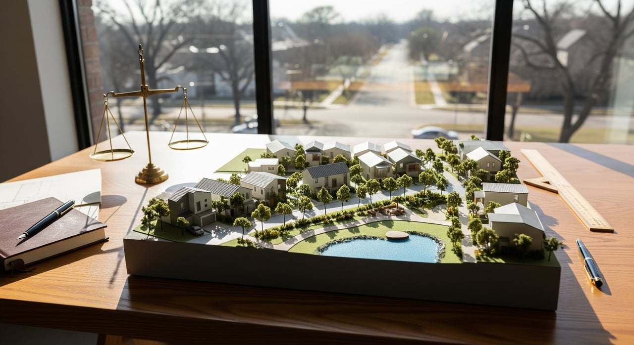
Trying to figure out where you’ll buy groceries, squeeze in a workout, and beat traffic in North Dallas? If you’re moving here or scouting a new neighborhood, it helps to see how everyday errands and routines line up around your home and commute. This guide gives you a clear, practical way to map groceries, parks, fitness, health care, shopping, and transit so your week runs smoothly. You’ll learn which amenities cluster where, what to expect with parking and peak times, and how to plan drive times and toll choices. Let’s dive in.
How we define North Dallas
For this guide, North Dallas means the part of the City of Dallas north of central Dallas, plus the adjacent north‑corridor suburbs that people often compare when relocating. Think Dallas neighborhoods north of downtown and central areas, together with Richardson, Plano, Addison, and Carrollton. For scope, picture the area from I‑30 up to President George Bush Turnpike and the Collin County line. Amenity density varies a lot block to block, so mapping your specific day‑to‑day is key.
Everyday shopping: grocers and markets
You have a wide mix of supermarket options across North Dallas and the north‑corridor suburbs. Full‑service choices include Kroger and Tom Thumb, and you’ll also find Whole Foods Market, Trader Joe’s, and Sprouts. Discount and warehouse choices include Aldi, Costco, and Sam’s Club. You’ll also see Hispanic and other international markets, including Fiesta and specialty stores in clusters across Richardson and north Dallas.
What to mark on your map:
- Full‑service supermarkets, noting extended hours and the best parking access.
- Natural and organic stores for specialty produce and prepared foods.
- Ethnic markets for international groceries and specialty ingredients.
- Warehouse clubs for bulk shopping and occasional gas discounts.
Practical tips:
- Most suburban centers have ample parking. In denser nodes, expect garages or limited street parking.
- Saturday mornings and early afternoons can be busiest. If you prefer quieter aisles, try weekday evenings.
- Add seasonal farmers markets to your weekend plan. The Dallas Farmers Market is central to the city, and you’ll see neighborhood markets in Plano and Addison. Check typical seasonal months and weekend hours when you build your schedule.
Natural and specialty
If you cook often or have dietary needs, map Whole Foods, Trader Joe’s, and Sprouts near your home and commute. Add notes for peak times and parking, especially in mixed‑use or mall‑adjacent sites.
International and ethnic options
Clusters of international markets sit in and around Richardson and along north Dallas retail strips. Pin these for weekly staples and specialty items, and pair them with nearby bakeries or butchers you’ll use often.
Warehouse and discount
Costco and Sam’s Club locations work well for a weekly bulk run. Add a note for gas pumps and the best entry points to avoid peak congestion.
Parks and trails for daily routines
North Dallas gives you a mix of linear trails and neighborhood parks that fit short walks, runs, and family time.
Top trails and parks to add:
- Katy Trail for a popular in‑city run and walk option, with easy morning and evening access.
- Northaven Trail and Cottonwood Trail segments for north‑central connectors.
- White Rock Lake for loops, water views, and multi‑use paths.
- Arbor Hills Nature Preserve in Plano for nature trails and varied terrain.
- Addison Circle Park for community green space and events.
Map the details that matter:
- Trailheads and parking lots, plus paved versus soft‑surface paths.
- Lighting for early or late workouts.
- Dog parks, playgrounds, restrooms, and shaded areas.
Climate note: North Texas summers are hot and humid. Morning and evening are the most comfortable times. Shade, water fountains, and rest stops can help you keep a consistent routine from June through September.
Fitness and wellness options
You’ll find large health clubs and many boutique studios across the corridor. Major chains include LA Fitness, Lifetime Fitness, YMCA branches, and Planet Fitness. Boutique options include Orangetheory, Pure Barre, CycleBar, CrossFit boxes, and yoga studios.
What to map:
- 24‑hour gyms for flexible schedules.
- Clubs with pools, which are helpful for families and cross‑training.
- Evening and weekend class schedules at boutique studios.
- Wellness and spa services near work or home for quick recovery or self‑care.
Hospitals and urgent care
For everyday peace of mind, map urgent care centers near your home, your children’s school, and your workplace. Major hospital systems serving North Dallas and the suburbs include Baylor Scott & White and Medical City facilities in the Plano and Frisco corridor, plus major Dallas hospitals such as Baylor University Medical Center and Medical City Dallas. When you compare neighborhoods, note drive times to the nearest full‑service hospital during both rush hour and off‑peak times.
Shopping, lifestyle, and essentials
North Dallas mixes destination malls with neighborhood shopping centers, so you can set up a “quick errand” loop that fits your routine.
Key retail hubs to know:
- NorthPark Center in north‑central Dallas for destination shopping and dining.
- Galleria Dallas along the northern edge of the city, near major interchanges.
- Legacy West and The Shops at Legacy in Plano for dining, shopping, and boutique fitness in a walkable node.
- The Shops at Willow Bend area in Plano for additional retail choices.
Add everyday services to your map:
- Pharmacies, dry cleaners, banks, and shipping centers for weekday errands.
- Pet services and groomers near parks and trails you use.
- Hardware stores and gas stations on your normal routes.
Parking is usually easy in suburban centers. In dense or mixed‑use areas, plan for garage parking and allow a few extra minutes.
Childcare, schools, and libraries
Public school district boundaries are an important factor for many families. The area includes Dallas ISD and neighboring districts such as Plano ISD, Richardson ISD, and Carrollton‑Farmers Branch ISD. Enrollment rules and attendance zones vary by district, so verify eligibility directly with the district during your home search.
Childcare options include private centers and franchise networks like KinderCare and Primrose, along with licensed home daycares. Availability can change quickly, so add your preferred centers to the map and note waitlist policies.
Libraries and community resources are strong anchors for family routines. Pin Dallas Public Library branches, Plano Public Library locations, and nearby community centers. These often offer weekly story times, study spaces, and city recreation programs.
Health care and emergency access
A practical relocation map includes urgent care clusters, hospital campuses, specialty clinics, and pharmacy options. For each home on your list, measure the distance and typical drive time to the nearest full‑service hospital and urgent care during rush hour. Add notes for 24‑hour pharmacies, and include pediatric and primary care offices you plan to use.
Commute corridors and transit
Day‑to‑day in North Dallas is shaped by a few key roadways. US‑75, or Central Expressway, links central Dallas to Richardson and Plano and carries heavy commuter flows. The Dallas North Tollway runs north and south from downtown to Plano and beyond. I‑635, also known as LBJ Freeway, is the east‑west loop through north Dallas, and President George Bush Turnpike forms a northern belt across the suburbs. Local arterials such as Preston Road, Coit Road, Forest Lane, and Belt Line Road round out your options.
Tolls are common on the Dallas North Tollway and President George Bush Turnpike. Many commuters use a regional toll transponder for discounted and seamless travel. If your job sits along a toll corridor, plan your monthly budget and time savings.
Transit can work well when your home and office line up with DART light rail. The Red Line and Orange Line extend north into Plano, and there is local DART bus coverage to many shopping and office nodes. Regional services like the Trinity Railway Express and the Denton County A‑Train help with broader metro travel, though coverage can be limited for some North Dallas neighborhoods. Most suburban areas still rely primarily on cars, so plan for both rush hour and alternate routes.
Where amenities cluster
Amenity density changes quickly from block to block, so focus on the nodes that match your lifestyle.
Higher‑density, more walkable areas:
- Uptown and the NorthPark area for a mix of shopping, restaurants, and urban trails like the Katy Trail.
- Legacy and Legacy West in West Plano for a walkable core with dining, boutiques, and fitness.
- Downtown Plano for a neighborhood main street feel near transit stations.
Lower‑density, car‑oriented areas:
- Preston Hollow, Far North Dallas, and many Plano subdivisions concentrate amenities in shopping centers. You will likely drive for groceries, school drop‑offs, and recreation.
Emerging and edge clusters:
- Interchanges along the Dallas North Tollway, the Galleria area, and office parks in Richardson and Plano often have clusters of gyms, coffee shops, and grocery anchors.
Walkability and comfort can vary within the same neighborhood. Use a street‑level view and local tools to understand block‑by‑block differences and typical foot traffic.
Build your North Dallas amenities map
Use this framework to create a living map that supports your daily routine.
- Set your scope
- Use I‑30 as the southern edge and President George Bush Turnpike as the northern belt for reference.
- Center the map on your current or target home and add your workplace and school locations.
- Add drive‑time rings
- Create 10, 20, and 30‑minute rings around your home and work. This helps you pick a primary grocery store, the best gym, and a realistic park for daily walks.
- Layer your categories
- Grocers by type: full supermarket, natural and organic, ethnic markets, and warehouse clubs.
- Parks and trailheads: include dog parks, lighting, restrooms, and shaded areas.
- Fitness and wellness: 24‑hour gyms, clubs with pools, and favorite studios.
- Shopping centers and everyday services: pharmacies, cleaners, banks, shipping, hardware, and gas.
- Schools and childcare: public school district boundaries, your nearest schools, and preferred childcare centers.
- Health care: hospitals, urgent care, primary care, pediatric clinics, and 24‑hour pharmacies.
- Transit: DART rail stations, park‑and‑ride lots, and bus connections.
- Commute corridors: US‑75, Dallas North Tollway, I‑635, President George Bush Turnpike, and your best east‑west and north‑south alternates.
- Seasonal: farmers markets and community event locations.
- Add practical notes
- Parking: ample lot versus street or garage only; note validated parking if offered.
- Hours: extended or 24‑hour options for grocers, gyms, and pharmacies.
- Peak times: Saturday mid‑day peaks at supermarkets, evening peaks at gyms.
- Summer strategy: early or late trail use, shaded paths, and water access.
- Family planning: waitlists at childcare centers and recreation program sign‑ups.
- Toll strategy: whether a transponder will meaningfully shorten your commute.
- Test your week
- Plan a week of errands with real departure times and routes. Try a weeknight grocery run, a Saturday bulk shop, a morning trail session, and your normal commute. Adjust your “go‑to” picks based on actual time and parking experience.
Sample weekly routine in North Dallas
- Monday: Early gym session at a 24‑hour location, then hop on US‑75 or the Dallas North Tollway depending on your office. Evening pickup at nearby childcare and a quick grocery stop for mid‑week produce.
- Wednesday: Evening boutique fitness class near home or work. Add a note for parking in mixed‑use centers and arrival times to avoid rush.
- Friday: Family dinner at a retail hub like NorthPark, Galleria, or Legacy West. Park in a garage, and plan a short walk.
- Saturday: Bulk run to Costco or Sam’s Club in the morning. Add gas if lines are light. Afternoon park time at White Rock Lake or Arbor Hills, with shaded paths and water breaks.
- Sunday: Farmers market visit when in season, then a trail walk on the Northaven or Cottonwood Trail. Prep for the week with a pharmacy run and a quick hardware pickup along your normal route.
Seasonal and relocation tips
- Summer heat shapes routines. Plan workouts in the morning or evening and favor shaded trails and pool access.
- Farmers markets and outdoor events are seasonal. Check months and weekend hours as you plan.
- Parking is simple in most suburban centers. In dense nodes, budget time for garage parking and short walks.
- Delivery is widely available for groceries and restaurants if your schedule is tight.
- School boundaries matter. Always verify enrollment and transfer policies with the district.
- Flood zones near creeks and lakes can affect both properties and trails. Check local maps when you compare neighborhoods.
- Construction is common along the corridor. Expect new retail and road work to shift traffic patterns and add options over time.
Local guidance when you need it
A clear amenities map turns a move into a routine you can trust. If you want neighborhood‑level advice, comparisons across Richardson, Plano, Addison, Carrollton, and North Dallas, or help pairing lifestyle needs with a short, reliable commute, our team is here to help. Start a conversation with Mark Bradford for a tailored plan, on‑the‑ground insight, and a smooth path to the right home.
FAQs
What areas does “North Dallas” include for this guide?
- North Dallas includes the part of the City of Dallas north of central Dallas and nearby suburbs such as Richardson, Plano, Addison, and Carrollton, roughly from I‑30 to President George Bush Turnpike.
Which groceries and markets are common in North Dallas?
- You’ll see Kroger, Tom Thumb, Whole Foods, Trader Joe’s, Sprouts, Aldi, Costco, Sam’s Club, and ethnic markets like Fiesta, along with specialty international stores.
How walkable are North Dallas neighborhoods for daily errands?
- Walkability varies by block. Dense nodes like Uptown, NorthPark area, Legacy West, and Downtown Plano are more walkable, while many residential areas are car‑oriented.
What are the main commute roads in North Dallas?
- US‑75, Dallas North Tollway, I‑635, and President George Bush Turnpike are the primary corridors, with Preston Road and Coit Road as key arterials.
Can I rely on public transit for my commute in North Dallas?
- Transit can work if your route aligns with DART light rail or strong bus connections, but most suburban locations still depend on driving.
Where are the best daily trails for runs and dog walks?
- Inside the city, try the Katy Trail and White Rock Lake. In the suburbs, Arbor Hills in Plano and neighborhood trail connectors are solid daily options.
How should I handle toll roads in my routine?
- If you use the Dallas North Tollway or President George Bush Turnpike often, a regional toll transponder can help streamline travel and may reduce drive times.
What should families map besides schools?
- Add childcare centers, libraries, recreation programs, nearby parks with playgrounds and restrooms, and clinics or urgent care near home and school.